
St Christopher's Place is a pedestrian courtyard fifty metres from the exit of Bond Street station, reached through a passage so narrow that most of the Oxford Street crowd walks past it. It was built as model tenements for the poor in 1882, and the inscription saying so is still over the door of the flats. It is one of five passages that get you off the pavement within two minutes, and this page covers all of them.
Oxford Street is a mile and a half long, carries some of the heaviest pedestrian traffic in Europe, and has almost nowhere to sit down. The alleys are the answer, and they are genuinely hard to find: the entrances are single-shopfront gaps between stores, usually with no sign at street level beyond a small nameplate.
Our guide to Oxford Street covers the shops and the traffic-free works, and where to eat near Oxford Street compares the courtyard with the alternatives and gives what a main course costs in each. This page is about the passages themselves: where each entrance is, what is down it, which way it takes you, and what the courtyard was before it had restaurants in it.
The five ways off Oxford Street
- Gees Court and St Christopher's Place
- North side, opposite Bond Street station. Fifty metres to the courtyard. Restaurants, outdoor tables, small shops
- South Molton Street
- South side, next to Bond Street station. Pedestrianised, listed Georgian terraces, leads down to Brook Street and Mayfair
- Market Place
- North side, two minutes west of Oxford Circus. A small square behind the shops with tables
- Ramillies Place and Argyll Street
- South side at Oxford Circus. The way to the London Palladium and Carnaby
- Stratford Place
- North side, east of Bond Street station. A dead-end cul-de-sac with a Grade I listed house at the top. Nothing to buy, nobody in it
Finding the entrance, which is the whole difficulty
Come out of Bond Street station on the north side of Oxford Street and look for a gap between two shopfronts, more or less opposite the station exit. That gap is Gees Court: a covered passage a couple of metres wide, which opens after about thirty paces into the first of the courtyard's two squares. Transport for London's walking directions give fifty metres from the station to the courtyard, which is about forty seconds.
The courtyard then runs north as a pedestrian lane, crosses Barrett Street, widens into a second small square with more tables, and comes out on Wigmore Street at the top. You can walk the whole thing in three minutes. The confusing part is that all three sections are called St Christopher's Place on the signs, while the map calls the southern passage Gees Court and the middle part Barrett Street.
If you cannot find the gap, walk to Barrett Street instead. The northern half of the courtyard is much easier to enter: from Wigmore Street, turn down beside the department store and you are in the wide end within twenty metres. Come in from the top and out at the bottom, rather than hunting for a two-metre entrance in a crowd.
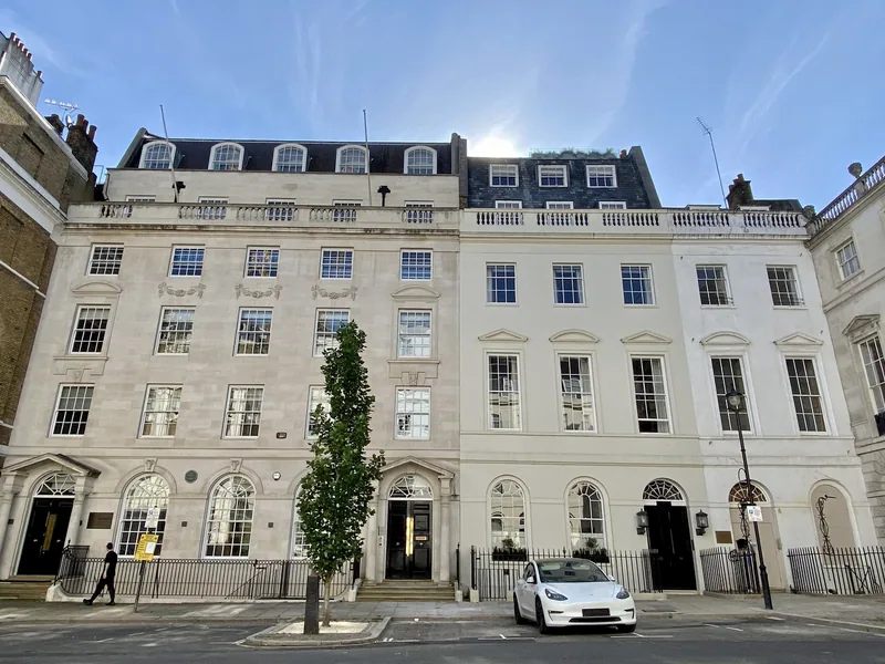
Photo: No Swan So Fine · CC BY-SA 4.0 · Wikimedia Commons · resized
What the courtyard was before the restaurants
This is the part nobody mentions, and it is standing in front of you.
The block at 23 to 31 St Christopher's Place is listed Grade II, added to the national list on 1 December 1987. Historic England describes it as a block of tenements with shops, dated 1882, in red brick with cut brick enrichment and slate roofs, in what the listing calls a Commercial Gothic style: five storeys, eleven windows wide, with pavilions at each end and a gabled entrance pavilion slightly forward of the rest. The shopfronts and the deep-set first-floor windows sit inside an arcade.
The detail to look for is above the door to the flats. The listing records an ornamented panel inscribed South St. Christopher's Buildings, with the date 1882 carved on the first floor above it. That is the original name of the building, and it tells you what this courtyard was: model dwellings, put up to rehouse people from the slum courts that stood here before, at the end of a decade of housing reform in the West End. The restaurants are a hundred years younger than the buildings they occupy.
Nothing else in the courtyard is listed. The 1882 block is the reason the passage survives at all: it is why the frontage on Oxford Street could not simply be widened and the court built over.
The courtyard today, and what is wrong with it
It is pleasant, it is sheltered, the tables are outside from spring to autumn, and there are gas heaters in winter. It is also a small courtyard directly behind the busiest shopping street in Britain, and it is priced like one. Our Oxford Street eating page gives the price range for a main course here against the range two streets further west, and the gap is real.
There is a harder point to make, and we make it because we have checked. Reading the Food Standards Agency's register for St Christopher's Place in September 2026 returns nine establishments with a W1U postcode. Seven were rated four or five at their last inspection. One was rated zero, in February 2026, and one had not yet been inspected. A courtyard is not a guarantee: the rating is per kitchen, not per postcode.
Check the rating before you sit down, not after. Hygiene ratings on this courtyard ranged from zero to five in September 2026. Every business must display its rating, but in London it does not have to be in the window. Search the address on the Food Standards Agency register, which takes fifteen seconds on a phone, and pick a different table if you do not like the answer.
The businesses we are willing to name here are the ones that held four or five stars at their most recent inspection in September 2026: Côte Brasserie at 6–8, Ristorante Olivelli at 9, Myka at 12–14, Angelique's Wine House at 18–19, Noreen at 28–32, Marugame Udon at 1 and Morena at 15. Ratings change at every inspection, so treat that as a snapshot and check the current one.
South Molton Street, which is the better walk
Directly opposite, on the south side of Oxford Street beside the station, South Molton Street is the alley most people should take. It is fully pedestrianised, it is wider, and it is lined with genuine Georgian houses rather than Victorian tenements: Historic England lists numbers 10–12, 14–16, 18, 19 and 20, 21, 24 and 25, 26, 41, 50 and 63, with number 17 listed at the higher Grade II*, most of them added to the list in 1970 or 1981.
It also goes somewhere. Follow it south and it delivers you to Brook Street and the edge of Mayfair in four minutes, which is the single most useful piece of West End geography a first-time visitor can learn: the shops stop, the noise stops, and you are in Mayfair. Our guide to Mayfair and St James's picks it up from there.
The other three, and what each is for
Market Place sits behind the shops two minutes west of Oxford Circus on the north side, off Great Titchfield Street. It is a genuine small square with tables in it and a Fitzrovia feel, and it is the closest sitting-down space to Oxford Circus itself. Our Oxford Street eating page covers what is there.
Ramillies Place and Argyll Street run south from Oxford Circus and are the route to the London Palladium and, beyond it, Carnaby Street and Soho. This is the alley to use if your evening ends at a theatre: see our guide to West End theatre for what is on.
Stratford Place is the odd one out and the one we would send you down for its own sake. It opens off the north side of Oxford Street a little east of Bond Street station and is a short, closed cul-de-sac with nothing commercial in it at all. At the head of it stands Stratford House, listed Grade I, with a porter's lodge in front of it and listed terraces at 2–7, 8–10, 12 and 13, 16 and 20 down each side. It takes ninety seconds, there is nowhere to spend money, and you will usually have it to yourself.
Timing, weather and the one hour to avoid
The courtyard is at its worst between roughly 12:30 and 14:00 on a weekday, when the offices behind Wigmore Street empty into it and every outdoor table is taken. It is at its best in the middle of the afternoon and in the early evening before the theatre crowd.
In rain the calculation changes. Gees Court is covered for its first stretch and the courtyard has awnings, which makes it one of the few places within a minute of Oxford Street where you can sit outside in bad weather; our guide to a rainy day in London has the wider options. In late November and December the courtyard puts up lights and gets much busier in the evening, and our page on London's Christmas lights covers the season.
For a quieter alternative with the same idea and better shops, walk ten minutes north-west to Marylebone Lane, which curves away from Oxford Street and has almost no chains on it. Our Marylebone guide covers what lies beyond.
Getting here and moving on
Bond Street station is the one to use: Central and Jubilee lines plus the Elizabeth line, with the courtyard fifty metres from the north-side exit. Oxford Circus is eight minutes east on foot, which TfL measures at 484 metres. Both are Zone 1, so a day of travel falls inside the £8.90 Zones 1 and 2 daily cap on contactless or Oyster.
Once you are in the courtyard you can reach a surprising amount on foot: the Wallace Collection in eight minutes north-west, Selfridges in three minutes west, Mayfair in four minutes south down South Molton Street and Soho in about ten minutes east. If you are choosing a base in this part of town, staying in Soho and Covent Garden and staying in Mayfair and Marylebone set out the trade-offs, and Christmas shopping in London explains the weeks when this whole area is best avoided.
Frequently asked questions
Where exactly is the entrance to St Christopher's Place?
On the north side of Oxford Street, roughly opposite the Bond Street station exit, through a narrow covered passage called Gees Court. It is a gap between two shopfronts about two metres wide with only a small nameplate, which is why so many people miss it. From the station to the courtyard is about fifty metres.
Is St Christopher's Place expensive?
Yes, relative to the cooking. It is a small courtyard immediately behind Britain's busiest shopping street, and prices reflect the location rather than the kitchen. It earns its money on a warm day, with children, or in the rain, when being forty seconds from Oxford Street is worth paying for. Two streets west is cheaper for the same food.
What was St Christopher's Place originally?
Model tenements. The Grade II listed block at numbers 23 to 31 is dated 1882 and still carries a panel inscribed "South St. Christopher's Buildings" above the entrance to the flats, with the date on the floor above. The courtyard replaced slum courts on the same ground, and the restaurants arrived roughly a century later.
Which alley off Oxford Street is best for a quick escape?
South Molton Street, on the south side beside Bond Street station. It is wider than the others, fully pedestrianised, lined with listed Georgian houses, and it takes you out into Mayfair in about four minutes rather than returning you to Oxford Street. St Christopher's Place is better if you want to sit down.
Is St Christopher's Place covered or outdoors?
Both. The entrance passage from Oxford Street is covered, and the courtyard itself is open to the sky with awnings and outdoor heaters over most of the tables. That makes it usable in rain and in cold weather, which is unusual this close to Oxford Street.
Sources
- Historic England - 23-31, St Christopher's Place, list entry 1235527, Grade II (checked September 2026)
- Historic England - Stratford House, The Oriental Club, list entry 1237107, Grade I (checked September 2026)
- Historic England - National Heritage List for England, South Molton Street and Stratford Place entries (checked September 2026)
- Food Standards Agency - food hygiene rating register (searched by address, St Christopher's Place W1U) (checked September 2026)
- Transport for London - Journey Planner, used for the walking distances from Bond Street station (50 metres) and Oxford Circus (484 metres) to St Christopher's Place (checked September 2026)
- Transport for London - daily and weekly fare capping (checked September 2026)