
A London postcode tells you the compass direction of a place, and almost nothing about how far out it is. E1 is on the edge of the City; E14 is Canary Wharf, four miles further east. If you are booking a hotel by its address, that difference is the whole point of this page.
Postcodes are the standard way of identifying an address in Britain. Every address has one, taxis and delivery drivers use them instead of street names, and a search box will find a place from its postcode faster than from anything else. For a visitor they are mostly a booking tool: the postcode in a hotel listing is the most reliable single clue to where you will actually be staying.
What they are not is a measure of distance from the centre, and they are not the same thing as the fare zones on the Tube map. Our page on London's travel zones explains the system that decides what a journey costs, which is a completely separate grid drawn by Transport for London.
How to read a postcode
- Example
- SE1 9GF
- SE
- Postcode area. In London, a rough compass direction
- SE1
- Postcode district. The part that matters when you book
- SE1 9
- Postcode sector, a neighbourhood-sized patch
- SE1 9GF
- Unit postcode, usually a handful of addresses or one large building
- Numbers in London
- Not arranged in rings. Low is not the same as central
The shape of a UK postcode
The Office for National Statistics describes the structure plainly: a postcode has an outward code of two to four characters and an inward code of three, and it works as a hierarchy of four levels. In SE1 9GF, SE is the postcode area, SE1 the district, SE1 9 the sector and the whole thing a unit postcode covering a small number of addresses.
There are 124 postcode areas in the United Kingdom and a little over 3,100 districts, so a district is a substantial piece of ground. In central London a district can be a single famous neighbourhood; out in the suburbs it can be several square miles.
The letters in the inward code carry no geography at all. Only the outward code, the part before the space, is worth reading.
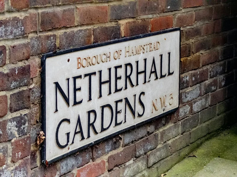
The eight London letter codes
Addresses that use LONDON as the post town fall into eight postcode areas, and the letters are compass directions from the middle of the city.
| Area | Means | Roughly covers |
|---|---|---|
| EC | Eastern Central | The Square Mile, running from Farringdon across to the Tower |
| WC | Western Central | Bloomsbury, Holborn, Covent Garden and the Strand |
| W | West | Soho, Mayfair, Marylebone, then Paddington and out to Ealing |
| SW | South West | Westminster, Chelsea, then Clapham and out to Wimbledon |
| SE | South East | The South Bank and Southwark, then Greenwich and further out |
| E | East | Whitechapel and Shoreditch's edge, then Hackney and the Docklands |
| N | North | Islington, then Highgate, Finsbury Park and out to Enfield's border |
| NW | North West | Camden and Regent's Park, then Hampstead and out to Wembley |
You will notice two gaps. There is no NE and no S in London: those letters now belong to Newcastle upon Tyne and Sheffield. Anything you read that places an address in "S London" as a postcode is using the phrase loosely, because south London splits between SE and SW with no code of its own.
EC and WC are subdivided further than the others. EC1 to EC4 and WC1 to WC2 are small enough that a single district can be walked across in fifteen minutes, and W1 is divided again into W1A, W1B, W1D and so on, because the West End generates more post than anywhere else in the country.
Why the numbers are not rings
This is the part that misleads visitors, and it is worth stating bluntly: within each letter code, the number does not increase as you move outwards. Only the number 1 is reliably central, because it marks the district containing the head sorting office. Everything after that was allocated long ago on a basis that has nothing to do with distance.
The results are dramatic:
- E1 is Whitechapel and Aldgate, walking distance from the Tower of London. E4 is Chingford, on the edge of Epping Forest. E14 is Canary Wharf.
- N1 is Islington, ten minutes from King's Cross. N16 is Stoke Newington. N22 is Wood Green.
- SW1 is Westminster and Victoria. SW3 is Chelsea. SW19 is Wimbledon, seven miles out.
- SE1 is the South Bank and Borough. SE10 is Greenwich. SE16 is Rotherhithe.
So SW3 is not three times further from the centre than SW1, and SE16 is not further out than SE10. The number identifies a district; it does not rank it.
"Ten minutes from Tower Bridge" and an E14 postcode do not go together. Canary Wharf is a fine place to stay, with fast trains into the centre, but it is a business district four miles east of the Tower. If a listing's description and its postcode disagree, believe the postcode.
Where visitors actually stay, by postcode
These are the central districts that come up most often in accommodation listings, with the landmark that tells you where you are.
| Postcode | Area | You are near |
|---|---|---|
| WC2 | Covent Garden, Strand, Leicester Square | The theatres and the National Gallery |
| WC1 | Bloomsbury, Russell Square | The British Museum |
| W1 | Soho, Mayfair, Marylebone, Fitzrovia | Oxford Street and Regent Street |
| SW1 | Westminster, Victoria, Pimlico, Belgravia | Parliament and Buckingham Palace |
| SE1 | South Bank, Waterloo, Borough, Bermondsey | Tate Modern, Borough Market, the London Eye |
| EC1 | Clerkenwell and Farringdon | Smithfield and the edge of the City |
| EC2 | Moorgate, Liverpool Street | The City and the Shoreditch boundary |
| E1 | Whitechapel, Aldgate, Spitalfields | Brick Lane and the Tower |
| W2 | Paddington and Bayswater | Hyde Park and the Heathrow train |
| SW7 | South Kensington | The three big museums |
| NW1 | Camden Town, Regent's Park, Euston | Camden Market and the zoo |
| E20 | Queen Elizabeth Olympic Park | Stratford and Westfield |
Our rundown of where to base yourself in London compares these as places rather than as codes, and where to stay for a first visit narrows it further. If you are arriving by train, the postcode also tells you which terminus you will be closest to, which our guide to London's main railway stations explains.
A postcode is not a travel zone
Two different grids are laid over the same city and they do not match.
Postcodes are a Royal Mail creation for sorting post. Travel zones are a Transport for London creation for pricing journeys, drawn as concentric rings around the middle, with Zone 1 covering the centre and the numbers rising outwards. Zones behave the way visitors expect postcodes to behave, and postcodes do not.
A worked example. Notting Hill is W11 and sits in Zone 2. Shepherd's Bush is W12, one district further along the same letter code, and is also in Zone 2. Meanwhile SW19 in Wimbledon is Zone 3, and E20 at Stratford is Zone 2 or 3 depending on the station. There is no formula that converts one to the other.
What decides your daily fare is the zone, not the letters. Our comparison of Oyster and contactless explains how the caps work, and how a hotel one zone further out changes the number.
The Greater London addresses that are not "London"
Here is the second trap. Royal Mail's "post town" for an address is not the same as the local authority area, and large parts of Greater London do not use LONDON as their post town at all.
Addresses in Bromley, Croydon, Enfield, Harrow, Ilford, Kingston upon Thames, Romford, Sutton, Twickenham and Uxbridge, among others, use their own post town and their own letter codes: BR, CR, EN, HA, IG, KT, RM, SM, TW and UB. Many of these places are inside Greater London, served by the Tube or the Overground and covered by Oyster and contactless. They simply are not in the London postal districts.
For a visitor, an address with one of those codes is a signal to check the journey time before booking. Some are genuinely convenient: Twickenham is fine for rugby, Kingston is pleasant, and a hotel near an Overground station in Harrow may be excellent value. Others are a 50-minute trip each way. Look the station up rather than assuming.
The reverse also happens. A few places well outside Greater London, such as parts of Hertfordshire and Essex, appear in listings as "London" because of an airport name or a marketing decision. An address near Luton or Stansted is not in London by any measure; our guide to staying outside London to save money sets out when that trade is worth making.
Using postcodes while you are here
Postcodes are the practical currency of finding things in Britain, and a few habits help.
Type the postcode into a map app rather than the street name, because street names repeat: there are dozens of High Streets and several Church Roads. A full unit postcode narrows it to a few addresses, and usually to the right building. Any of the mapping apps on our list of apps worth having in London will accept one.
Give a driver the postcode as well as the street. Black cab drivers know central London street by street, but a minicab driver working from a satnav needs the code. How each kind of car has to be booked is set out on our page about taxis and ride-hailing in London.
Postcodes are also the search key for local services: searching a launderette or a pharmacy "near SE1" gives you a far better answer than searching near a landmark, as our page on doing laundry in London explains.
Two limits worth knowing. The ONS points out that postcode boundaries mostly do not line up with administrative boundaries, so a postcode does not reliably tell you which borough you are in. And postcodes change: new addresses are added, and a code can be reused elsewhere after a couple of years, so a very old address may no longer resolve.
Frequently asked questions
What do London postcode letters mean?
They are compass directions from the centre: EC is Eastern Central, WC Western Central, and then N, NW, W, SW, SE and E. There is no NE or S in London, because those letters now belong to Newcastle and Sheffield. Only the part of the code before the space carries any geography.
Why is E1 nowhere near E14?
Because the numbers within a London letter code were not allocated by distance. Only the number 1 is reliably central, marking the district with the head sorting office. E1 is Whitechapel and Aldgate, next to the City; E14 is Canary Wharf, about four miles further east. The same applies to SW1 and SW19, and to N1 and N16.
Is a postcode the same as a London travel zone?
No. Travel zones are drawn by Transport for London as rings around the centre and decide what a journey costs. Postcodes are Royal Mail's system for sorting post and follow no such pattern. Two adjoining postcode districts can be in different fare zones, and two districts with very different numbers can be in the same one.
Is a hotel with a Croydon or Ilford postcode in London?
It is usually inside Greater London, but not in a London postal district: those addresses use their own post town and codes such as CR and IG. Many are on the Tube or Overground network and are covered by Oyster and contactless, but journey times into the centre vary a lot. Check the nearest station and the travel time before booking.
How precise is a UK postcode?
Very. A full postcode such as SE1 9GF usually covers a small number of addresses, and a large building can have one to itself. That is why entering the postcode into a map app or giving it to a driver works better than a street name, which may be repeated in several parts of the city.
Sources
- Office for National Statistics - Postal geography: postcode structure and limitations (checked September 2026)
- Royal Mail - Postcode finder (checked September 2026)
- Transport for London - Fare zones and capping (checked September 2026)