
In central London, walking is often as fast as the Tube, and sometimes faster: many neighbouring stations are only a few hundred metres apart, and TfL itself says 109 journeys between neighbouring central London stations are quicker on foot. For short hops in the West End, the City and along the river, walk; save the Tube for longer distances.
The Tube map is a diagram, not a street map. It spreads central London out so that the lines are easy to read, which makes stations that are almost next to each other look far apart. Leicester Square and Covent Garden, for example, are one stop apart on the Piccadilly line but only about 400 metres apart in the street.
Every Tube trip also has hidden time: walking through the station, going down escalators, finding the platform, waiting for the train and climbing back to the street. For a one-stop journey, that often takes longer than the walk. This guide shows which stations are closest together, suggests the best walks for visitors, and explains how to find your way and stay safe on foot.
Walking in central London: quick facts
- Neighbouring stations quicker on foot
- 109 journeys in central London (TfL)
- Leicester Square to Covent Garden
- About 400 m, around 6 minutes' walk
- Charing Cross to Embankment
- About 220 m, around 2 minutes' walk
- Street signs
- Legible London maps, navy blue and yellow
- Riverside walking route
- Thames Path, 40 miles from Hampton Court to East India Dock
- Cost
- Free; a Zone 1 Tube fare is £3.00 off-peak
Why the Tube map makes walking look harder than it is
The famous map was designed to show connections, not distances. Lines are drawn straight, stations are evenly spaced, and the centre is enlarged. That makes it excellent for planning a Tube trip and poor for judging whether you need one.
Several things make short Tube journeys slower than they look:
- Deep stations. Many central platforms are far below the street, reached by long escalators, stairs or lifts.
- Long passages. Changing lines can mean several minutes of walking inside the station.
- Waiting and crowds. Even with frequent trains, you wait, and at busy stations you may queue to get onto the platform.
Add those together and a one-stop ride can easily take ten minutes from street to street, while the walk takes five. Our guide to the London Underground explains how the lines work when you do need them.
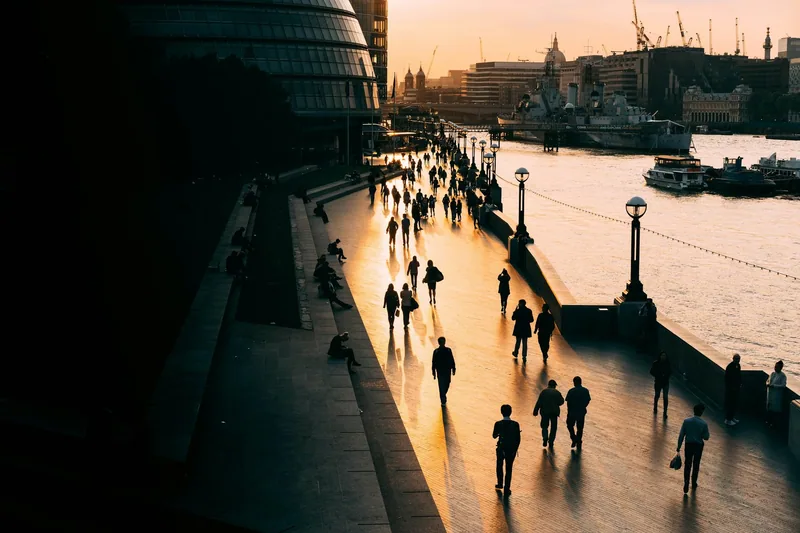
Stations that are a short walk apart
These walking times come from TfL's Journey Planner, for a weekday late morning. They are measured between station entrances, so your own time depends on your pace, the crowds and how long you wait at crossings.
| Between | Walking time | Walking distance (approx.) | By Tube |
|---|---|---|---|
| Charing Cross and Embankment | 2 min | 220 m | 1 stop (Northern, Bakerloo) |
| Mansion House and Cannon Street | 2 min | 170 m | 1 stop (District, Circle) |
| Queensway and Bayswater | 2 min | 190 m | Different lines |
| Great Portland Street and Regent's Park | 3 min | 200 m | Different lines |
| Bank and Mansion House | 4 min | 270 m | 2 stops from Monument (District, Circle) |
| Leicester Square and Covent Garden | 6 min | 400 m | 1 stop (Piccadilly) |
| Piccadilly Circus and Leicester Square | 6 min | 410 m | 1 stop (Piccadilly) |
| Holborn and Covent Garden | 6 min | 510 m | 1 stop (Piccadilly) |
| Goodge Street and Tottenham Court Road | 6 min | 400 m | 1 stop (Northern) |
| Tottenham Court Road and Leicester Square | 7 min | 470 m | 1 stop (Northern) |
| Oxford Circus and Piccadilly Circus | 10 min | 630 m | 1 stop (Bakerloo) |
| Westminster and St James's Park | 10 min | 610 m | 1 stop (District, Circle) |
| Euston and King's Cross St Pancras | 13 min | 650 m | 1 stop (Northern, Victoria) |
Some of these pairs are on different lines, so going by Tube would mean a change or a detour. Queensway (Central line) and Bayswater (District and Circle lines), for instance, are a couple of minutes apart on foot, while a Tube journey between them would take a roundabout route.
Around Covent Garden and Leicester Square
The busiest part of the West End is also where walking pays off most. Leicester Square, Covent Garden, Piccadilly Circus and Tottenham Court Road stations sit close together, and the streets between them are part of the attraction: Chinatown, Seven Dials, the theatres of Shaftesbury Avenue and the piazza of Covent Garden.
Covent Garden station is often crowded, especially at weekends and before evening shows. If you are heading to the market or a theatre nearby, getting off at Leicester Square or Holborn and walking a few minutes is usually easier. From Covent Garden's piazza, Trafalgar Square is about 10 minutes on foot, according to TfL's Journey Planner.
Walking one stop saves a fare as well as time. A Zone 1 Tube journey costs £3.00 off-peak with contactless. For a group of four adults making three one-stop hops a day, walking instead can save up to £36 over a day, unless you would have reached the daily cap anyway. Our guide to fares and daily caps shows when the cap takes over.
Oxford Street and the Elizabeth line
Oxford Circus to Piccadilly Circus is one stop on the Bakerloo line, but the walk down Regent Street takes about ten minutes and passes some of London's best-known shop fronts. Oxford Circus to Bond Street is a similar story. Our Oxford Street guide covers the shops along the way.
The Elizabeth line has changed some of the distances here. Its central stations are long, with entrances at both ends of the platforms. Bond Street's Elizabeth line entrance at Hanover Square is only a few minutes' walk from Oxford Circus, and Tottenham Court Road's western entrance on Dean Street leads straight into Soho. If you are using the Elizabeth line, check which exit brings you closest to where you are going.
Classic walks that link the big sights
Many of London's best-known sights are close enough to see on foot in a day, and the walk between them is part of the experience. These times are from TfL's Journey Planner, without stops.
| Walk | Walking time | Distance (approx.) |
|---|---|---|
| Westminster Abbey to Buckingham Palace | 18 min | 1.2 km |
| Buckingham Palace to Trafalgar Square | 21 min | 1.3 km |
| Trafalgar Square to the British Museum | 25 min | 1.5 km |
| St Paul's Cathedral to Tate Modern | 13 min | 1 km |
| London Eye to Tate Modern (South Bank) | 24 min | 1.8 km |
| Tate Modern to Tower Bridge (south side) | 25 min | 1.9 km |
The South Bank, from the London Eye to Tower Bridge
If you only do one walk, make it this one. Following the south bank of the Thames from the London Eye to Tower Bridge takes around 50 minutes of walking in total, passing the Southbank Centre, Tate Modern, Shakespeare's Globe, Borough Market and HMS Belfast, with views across the river to St Paul's and the City. Most of the route is traffic-free. Our guide to the South Bank covers the stops along the way, and the bridges of London suggests where to cross.
Westminster to Trafalgar Square through the parks
From Westminster Abbey, walk through St James's Park to Buckingham Palace, then along The Mall to Trafalgar Square. It is a green, mostly flat walk of well under an hour, and it avoids the crowded pavements of Whitehall.
St Paul's to Tate Modern
From the steps of St Paul's Cathedral, the Millennium Bridge leads straight across the river to Tate Modern. The walk takes about 13 minutes and gives one of the best views of the cathedral dome.
Trafalgar Square to Bloomsbury
Walk north through Covent Garden or Soho to the British Museum in about 25 minutes. On the Tube, the same trip would mean a change of line or a walk from the station at either end.
Longer walking routes
TfL promotes eight long-distance routes, together called the Walk London Network, with free maps and written directions for each section. Two suit visitors in particular:
- The Jubilee Walkway links many of central London's landmarks, from St Paul's to Buckingham Palace, and includes Bloomsbury and the City.
- The Thames Path offers 40 miles of level walking along both sides of the river, from Hampton Court Palace through central London to East India Dock.
Both can be walked in short sections, and each section starts and ends near public transport. For a guided option, see our pick of the best walking tours in London, and for more ideas that cost nothing, our list of free things to do in London.
Finding your way on foot
Central London's streets are not laid out in a grid, and street names change often. Fortunately, the city is well signposted for walkers.
- Legible London signs. These are map-based street signs with a distinctive navy blue and yellow design, found on streets, in bus shelters and at stations. TfL says they show realistic walking times to nearby places, typically 5 to 15 minutes away.
- TfL walking maps. TfL publishes free walking maps for the West End and the City of London as PDFs on its walking page.
- Journey planners. TfL's Journey Planner and the TfL Go app can plan walking routes, and will tell you when walking is quicker than the Tube.
Check the exit before you leave the station. Large stations such as Bank, King's Cross St Pancras and the Elizabeth line stations have several exits, sometimes hundreds of metres apart. The signs inside the station name the streets each exit leads to, and choosing the right one can save you a long walk above ground.
Staying safe on London's streets
Traffic in Britain drives on the left, which means the first vehicles reach you from the right. Visitors from right-hand-traffic countries instinctively look the wrong way, so many crossings in central London have "LOOK RIGHT" or "LOOK LEFT" painted on the road. Read them.
- Use the crossings. At signal-controlled crossings, wait for the green figure. At zebra crossings (black and white stripes with flashing orange beacons), traffic should stop for you, but make sure it has before you step out.
- Watch for cyclists and e-bikes. They are quiet and fast, and some roads have two-way cycle lanes. Look both ways before crossing any cycle lane.
- Buses turn tight corners. Stay back from the edge of the pavement at junctions.
- Keep your phone secure. According to the Mayor of London, around 71,391 mobile phones were stolen in London in 2025. Step to the side of the pavement, away from the kerb, to check a map. Our page on safety in London has more advice.
London pavements are busy, and people walk fast. If you need to stop, step to the side. On Tube escalators, stand on the right and leave the left side free for people walking.
When the Tube or bus is still the better choice
Walking is not always the answer. Take the Tube, a bus or a hire bike when:
- the distance is more than two or three stops, or crosses the centre;
- you have heavy luggage or a pushchair (though check for step-free stations);
- it is raining hard; our guide to London's weather helps you plan;
- you have limited mobility; TfL's step-free options are often easier than long walks between sights;
- it is late at night and you are unsure of the route.
A good rule of thumb for the centre: if the Tube map shows your destination one stop away, check the walking time first. If it is under ten minutes, walk.
Frequently asked questions
Is it quicker to walk than take the Tube in central London?
Often, for short distances. TfL says 109 journeys between neighbouring central London Underground stations are quicker on foot. Stations such as Leicester Square and Covent Garden are only about 400 metres apart. For journeys of more than a few stops, the Tube is usually faster.
What are the closest Tube stations in London?
Among central stations, Charing Cross and Embankment are about 220 metres apart, a two-minute walk according to TfL's Journey Planner. Mansion House and Cannon Street, and Queensway and Bayswater, are similarly close. Leicester Square and Covent Garden, one stop apart on the Piccadilly line, are about a six-minute walk.
Can you walk between most London attractions?
Many of the central sights are within walking distance of each other. Westminster Abbey to Buckingham Palace takes about 18 minutes, St Paul's to Tate Modern about 13, and the South Bank walk from the London Eye to Tower Bridge about 50 minutes without stops. Museums in South Kensington and places like Greenwich are better reached by public transport.
Is London a walkable city for tourists?
Yes, especially the centre. Distances between sights are often short, the streets are signposted with Legible London maps, and routes such as the Thames Path along the river are mostly traffic-free. Remember that traffic drives on the left, so look right first when crossing the road.
Sources
- Transport for London - Find your way around (Legible London) (checked September 2026)
- Transport for London - Walk London (checked September 2026)
- Transport for London - Walking (checked September 2026)
- Transport for London - Journey Planner (walking times, sample weekday) (checked September 2026)
- Transport for London - Single Fare Finder (checked September 2026)
- Mayor of London - Crackdown on mobile phone theft (checked September 2026)