
London has eight long-distance walking routes that are signposted the whole way, free to use and divided into short sections that each begin and end near a station. You do not need to walk any of them from end to end: the point is that you can join one for two hours on a Sunday morning and get the Tube home.
Transport for London calls them the Walk London Network. They range from the Thames Path, which runs along the river through the middle of the city, to the London LOOP, which circles the outer suburbs at a distance of about fifteen miles from the centre. All of them are waymarked with discs or plaques, and TfL publishes a free map and written directions for every section.
Our guide to walking in London covers the short hops between sights in the centre, and the best walking tours in London covers guided walks. This page is about the four routes a visitor is most likely to use, what each one is actually like underfoot, and exactly where to get on and off.
The four routes at a glance
- Thames Path
- 40 miles inside London, both banks, Hampton Court Palace to East India Dock. Flat, paved, busiest in the centre
- Capital Ring
- 78 miles in 15 sections, through the green suburbs. Mostly wheelchair accessible
- London LOOP
- Nearly 150 miles in 24 sections, almost encircling Greater London. Countryside, not city
- Jubilee Walkway
- A central loop past the landmarks, from St Paul's to Buckingham Palace
- Cost
- Nothing. Maps and directions are free downloads from TfL
- The others
- Green Chain, Green Link, Jubilee Greenway and the Lea Valley Walk complete the eight
The Thames Path, and the difference between the trail and the London stretch
Two things share the name, which confuses people. The Thames Path National Trail is a 185-mile route that begins at the river's spring in Gloucestershire and finishes at Woolwich; it was inaugurated at the Thames Barrier on 24 July 1996, which makes 2026 its thirtieth year. Since January 2022 it has connected at Woolwich Foot Tunnel to the England Coast Path, so it is now possible to keep walking east to the Kent coast.
What TfL promotes is the London portion: about 40 miles of level walking, on both banks, between Hampton Court Palace in the south-west and East India Dock in the east. This is the part that matters to a visitor, and it is the only one of the four routes that runs through the centre of the city.
Because both banks are walkable through central London and there are bridges every few hundred metres, the Thames Path is less a route than a system. You can cross whenever the other side looks more interesting. Our guide to the bridges of London covers which crossings are worth taking.
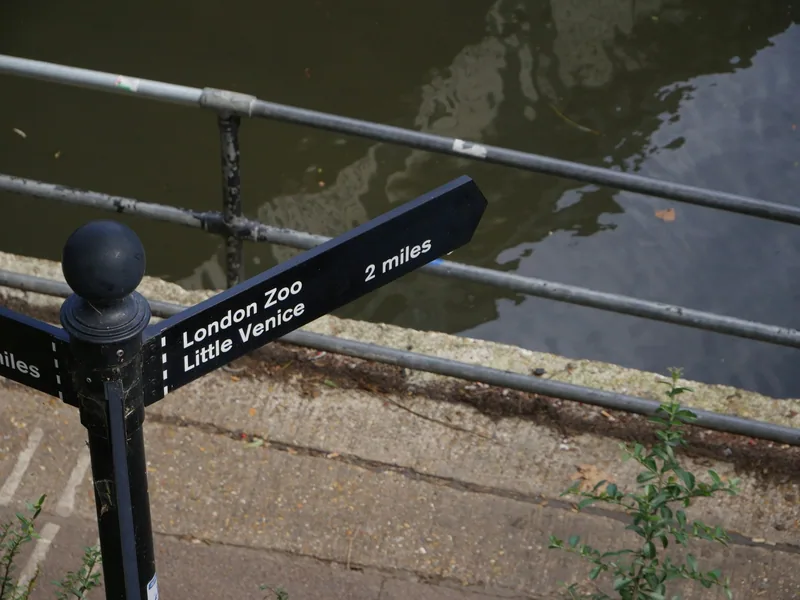
Four pieces of the Thames Path that work as half-days
| Stretch | Walking time | Join at | Leave at |
|---|---|---|---|
| Hampton Court to Kingston (south bank) | About 1 hour | Hampton Court rail station | Kingston rail station |
| Richmond to Kew (either bank) | About 1 hour | Richmond (District line, Mildmay line, rail) | Kew Gardens (District line, Mildmay line) |
| Putney to Hammersmith (south then north) | About 1 hour 15 minutes | Putney Bridge (District line) | Hammersmith |
| Tower Bridge to Greenwich (south bank) | About 2 hours | Tower Hill or London Bridge | Cutty Sark DLR |
The upstream stretches are the quiet ones. Between Hampton Court and Kew the path is a proper riverside towpath with rowing clubs, swans, pubs with gardens and almost no traffic noise, and it links two of the best days out in west London: Hampton Court Palace at one end and Kew Gardens at the other.
Downstream of Tower Bridge is the stretch most visitors never try, and it is the most interesting walk in London on a clear afternoon. Past Butler's Wharf the path threads between converted warehouses through Bermondsey, Rotherhithe and Deptford, with the river always on your left and the towers of Canary Wharf growing ahead of you. It ends at the Old Royal Naval College in Greenwich, with a DLR station to bring you back. Our guide to Wapping and Rotherhithe covers what to look at on the way.
The riverside path is not continuous everywhere east of Tower Bridge. In a few places a private development forces a short detour inland along a street before the route returns to the water. The waymarking is good, but follow the signs rather than the river when they disagree.
The Capital Ring: London's green suburbs, in fifteen pieces
The Capital Ring is a 78-mile circle at a radius of roughly seven miles from the centre, broken into fifteen sections. Walk it and you see the city as its residents know it, threaded through more decent parkland than any comparable route in Britain.
It takes in Richmond Park, Wimbledon Common and Eltham Palace, along with Hampstead Heath, the Lee Navigation and the woods of south-east London. Each section is between four and eight miles and ends at a station, which is the whole design principle: you do one, get a train home, and pick the next one up another weekend.
For a visitor with one free day, the section through Richmond Park and the one across Hampstead Heath are the two to choose. Both give long views over the city, both are on the network rather than National Rail at one end, and both can be shortened without spoiling them.
Unusually for a long-distance path, most of the Capital Ring is accessible to wheelchair users, and the Ramblers publish a guide to which parts are and are not. If that matters to your group, read it before you pick a section, and see our guide to London transport in a wheelchair for getting to the start.
The London LOOP: the outer circle, and whether it is worth the journey
The London Outer Orbital Path is the big one: close to 150 miles, in 24 sections, almost completely encircling Greater London near the boundary with the countryside. It runs through Epping Forest, the Cray valley, the Hertfordshire fringe and the fields beyond Uxbridge.
Be honest with yourself about this route. It is a superb walk, and it is a poor use of a short holiday. Reaching the start of a LOOP section usually means forty minutes to an hour on a train each way, and what you find at the end is countryside rather than London. If you have five days in the city, spend them elsewhere.
If you have a fortnight, or you are visiting somebody who lives out there, two sections repay the journey: the stretch through Epping Forest in the north-east, which is genuine ancient woodland reachable on the Central line, and the chalk-and-river section in the far south-east. For a proper day in the country, Box Hill and the Surrey Hills offer better walking for the same travelling time.
The Jubilee Walkway: the landmark loop in the middle
The Jubilee Walkway was created for Queen Elizabeth II's Silver Jubilee in 1977 and links the buildings visitors come to see: St Paul's Cathedral, the City, Bloomsbury, Covent Garden, Westminster and Buckingham Palace, with a long stretch on the South Bank.
It is the only one of the four that doubles as a sightseeing route, and it overlaps heavily with a walk you would probably do anyway. Its usefulness is the waymarking: when you are somewhere in the middle of the City with no idea which way is the river, a Jubilee Walkway plaque in the pavement settles the argument.
The route is entirely paved and entirely urban, with no gates, stiles or mud. The trade-off is crowds: between Westminster Bridge and Tower Bridge the South Bank is busy from mid-morning until late evening every day of the year. Walk it before 09:00 and you have it almost to yourself.
The related Jubilee Greenway, created for the 2012 Games, starts at Buckingham Palace and links the 2012 Games sites, and its canal section through Little Venice and the Regent's Canal is the prettiest short walk of the lot.
What the ground is actually like, and what closes
None of these routes is difficult, but they are not all the same surface, and a few things shut.
- Park gates. Several routes cross royal and borough parks that lock their gates at dusk. Check closing times before an evening walk, particularly in winter when dusk falls before 16:00.
- Towpaths after rain. The upstream Thames Path and the Lea Valley Walk are unsurfaced in places and turn to mud. Wear something you do not mind ruining between November and March.
- High spring tides. A few short lengths of Thames riverside, particularly around Chiswick and Strand-on-the-Green, flood at the highest tides. The water is shallow and brief, but it is there.
- Building sites. London rebuilds its riverside constantly, and diversions appear and disappear. The signs are updated; the printed maps are not always.
- Cyclists. Towpaths and the Jubilee Greenway are shared with bicycles. Keep to one side and expect to be passed.
Rain is the usual complication rather than cold. Our guide to London weather and what to pack covers the footwear question, which in London means waterproof rather than sturdy.
Walking a section with children, a buggy or a wheelchair
The central Thames Path and the Jubilee Walkway are both fully paved and step-free for almost their whole length, with the exception of a handful of bridge approaches that use steps where a ramp exists a short distance away. A pushchair handles both easily. The stations at either end are the harder part, and our page on going round London with a pushchair deals with those.
The Capital Ring is the surprise here, because most of it is accessible to wheelchair users despite being a country-style path. The Ramblers' guide to wheelchair access on the Capital Ring, linked from TfL's walking pages, names the sections that work.
With children, pick a section with something at the end rather than in the middle: a park, a boat, a museum, an ice cream. The Richmond-to-Kew stretch does this well, and so does Tower Bridge to Greenwich, where the Cutty Sark is the reward. Our guide to London with kids has more on pacing a day.
Walk downstream and let the river bus bring you back. Uber Boat by Thames Clippers stops at Tower, Greenwich and other piers along the eastern Thames Path, so you can walk one way and sail the other. It is not included in the daily fare cap, but it turns a long walk into a short one with a view.
Navigating, and what to carry
All eight routes are waymarked with their own logo: a disc, a plaque or a sticker on a lamp post. In the suburbs the waymarking is good. In the centre it competes with a great deal of other signage, so a map helps.
- TfL's free downloads. Every section of every route has a map and written directions as a PDF on the TfL walking pages. Download them before you go rather than at the trailhead.
- The Go Jauntly app, which TfL points walkers towards, follows the routes step by step.
- Legible London signs, the navy blue map pillars, appear along the central routes and give realistic walking times.
- Water. Refill points are widespread in London; see our guide to tap water and refill points.
- Toilets. Thin on the ground outside the centre. Our page on public toilets in London explains where to find them.
A phone is enough for navigation on the central routes and not quite enough on the outer ones, where signal is patchy in the wooded sections. Download the section map as a file rather than relying on a live connection.
Three half-days that work for a visitor
A calm morning: Richmond to Kew along the towpath, about an hour, ending with the gardens. Start from Richmond station, cross to the towpath and turn downstream. Both ends are on the District and Mildmay lines, so you never need a National Rail ticket.
An afternoon with a view: Tower Bridge to Greenwich, about two hours with stops, finishing at the Greenwich waterfront. Take the DLR back, or the river bus if the tide of tourists at Cutty Sark Pier is bearable.
An early start in the centre: the Jubilee Walkway between St Paul's and Westminster before breakfast, when the South Bank is empty and the light is on the City from the east. The bridges give the best free views in London at that hour, and they cost nothing.
Frequently asked questions
How long is the Thames Path through London?
Transport for London promotes about 40 miles of the Thames Path inside Greater London, on both banks, between Hampton Court Palace in the south-west and East India Dock in the east. The full Thames Path National Trail is 185 miles, starting at the river's source in Gloucestershire and ending at Woolwich.
Can you walk the Thames Path in one day?
Not the London stretch, which would be about 40 miles. Most walkers take a section of two to three hours and use public transport at each end. Popular single sections include Richmond to Kew, Putney to Hammersmith and Tower Bridge to Greenwich, all of which start and finish within a few minutes of a station.
Is the Capital Ring suitable for wheelchair users?
Most of it is. TfL states that the majority of the Capital Ring is accessible to wheelchair users and links to the Ramblers' guide to wheelchair access on the route, which sets out section by section what the surfaces and gates are like. Check that guide before choosing a section.
Do London's walking routes cost anything?
No. All eight Walk London Network routes are free public rights of way and shared paths, and TfL publishes free maps and written directions for every section as PDF downloads. The only cost is the fare to reach the start and come back from the end.
Which London walking route is best for sightseeing?
The Jubilee Walkway, which was created for the Silver Jubilee in 1977 and links St Paul's Cathedral, the City, Bloomsbury, Westminster and Buckingham Palace, with a long section along the South Bank. It is entirely paved and entirely urban, and it is the busiest of the four described here.
Sources
- Transport for London - Top walking routes and the Walk London Network (checked September 2026)
- National Trails - Thames Path (checked September 2026)
- Transport for London - Walking (checked September 2026)
- The Royal Parks - Visit the parks (checked September 2026)
- Transport for London - About the river bus (checked September 2026)